In the history of cartography, phantom islands are landmasses that were discovered by explorers and navigators, placed on maps–where they persisted for decades, sometimes centuries–only to later be debunked as sites that never existed.
Some phantom islands were born due to optical illusions experienced at sea; others were fraudulent inventions leveraged for colonial projects, nation building or reputational gain; others were simply the product of blending of myth and reality onto portolan charts and medieval maps which persisted through time. Perhaps unintuitively, the most recent un-discovery of a phantom island dates from 2012, when Sandy Island was removed from cartographic records, including digital ones such as Google Earth. These cartographic fictions, however, were rarely neutral: Bermeja's un-discovery in the early 2000s still shadows the maritime boundary and oil rights dividing Mexico from the United States.
Each work in the Still Nothing series is drawn from multispectral satellite imagery captured at a phantom island's reported coordinates, rendered in false color with spectral bands reassigned to register water depth, biological activity, and sediment through band ratios used by the remote sensing scientific community. These are speculative measurements directed towards detecting the presence of land. At the center of each frame, calibration target patterns are overlaid: the geometries used to teach aerial vision systems to see accurately, here standing in as the default markers of absence.
As our planetary observation systems become increasingly automated, with observation feeding prediction in a pipeline that performs as much reality-making as recording, phantom islands become fictions lodged inside an allegedly objective dataset. Historically, our infrastructures of knowledge production have always been partial and negotiated, each stacked layer amplifying the gaps beneath. Today's data-driven regime is no different.
The series currently contains six works, created from satellite data captured at the reported coordinates of the following phantom islands: Bermeja, Hy Brasil, Crocker Land, Sandy Island, Sannikov Land, and Los Jardines.
Still Nothing is part of End of Signal, a research-based body of work which examines the epistemic implications of AI deployed at scale, staged through a speculative future in which a satellite becomes an unreliable narrator of the reality on the ground. The project investigates what I term "technological underdetermination": a condition enabled by generative artificial intelligence, in which the unknown is produced by a surplus of plausible explanations rooted in existing ground truths, rather than by a scarcity of information.
A comprehensive presentation of the project can be found in this PDF document.
Production Credits
Sofía Enríquez G., curator
Laenz, sound design
Andreea Iliescu, 3D environment design
Yannis Siglidis, machine learning engineering
MK Skitka, creative technology
Sofía Enríquez G., print graphic design
Katelyn Rebelo, digital graphic design
Lindo Serviço, Estudios Durero, fabrication
Fine Print, printing
Elena Carbajal, exhibition coordination & production
María Castillo, Alessandra Gargiulo, exhibition design & production
Milena Fernández, communications
Special thanks: Alasdair Milne, OFFICE IMPART (Anne Schwanz and Johanna Neuschäffer), Artemis Gallery, Aisling Murray
End of Signal is the winning project of the SOLO AI ’25 AWARD, presented by SOLO Contemporary, and part of the exhibition programme of Onkaos. I would like to acknowledge the support of SOLO Contemporary and STUDIOTOPIA in the development of this project.
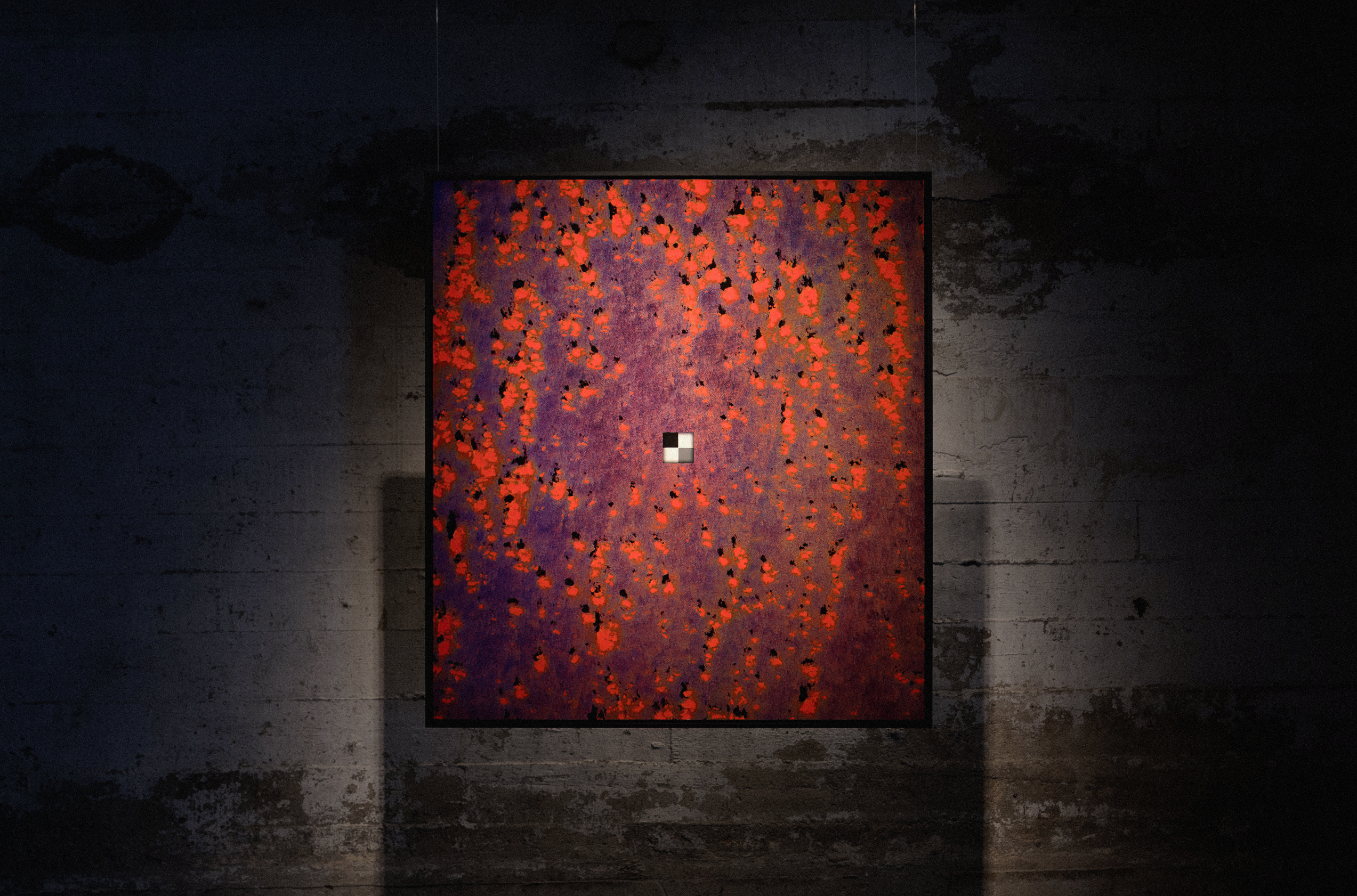
Still Nothing (Bermeja), multispectral satellite data, archival print on cotton-rag paper, 100cm x 111cm.
Image courtesy of Onkaos & SOLO Contemporary.
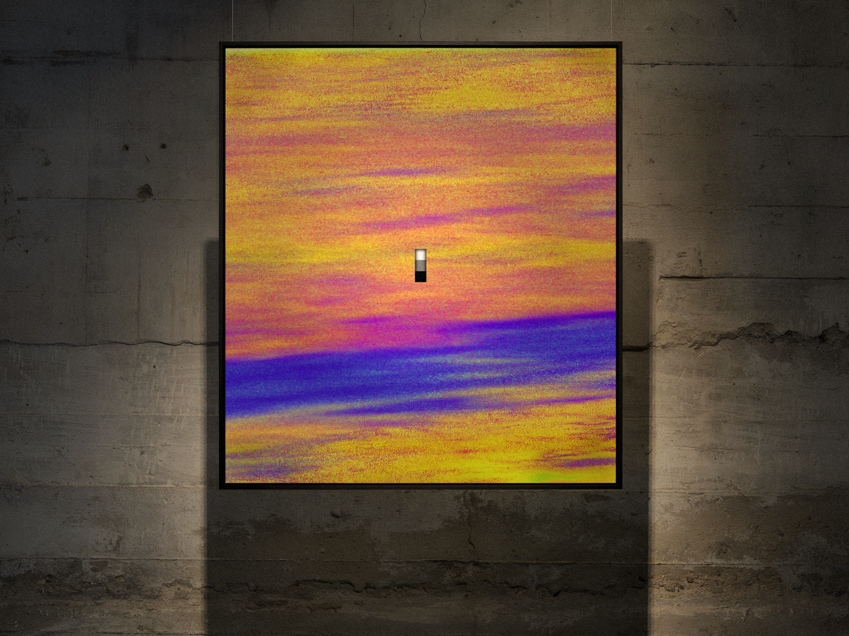
Still Nothing (Crocker Land), multispectral satellite data, archival print on cotton-rag paper, 100cm x 111cm.
Image courtesy of Onkaos & SOLO Contemporary.
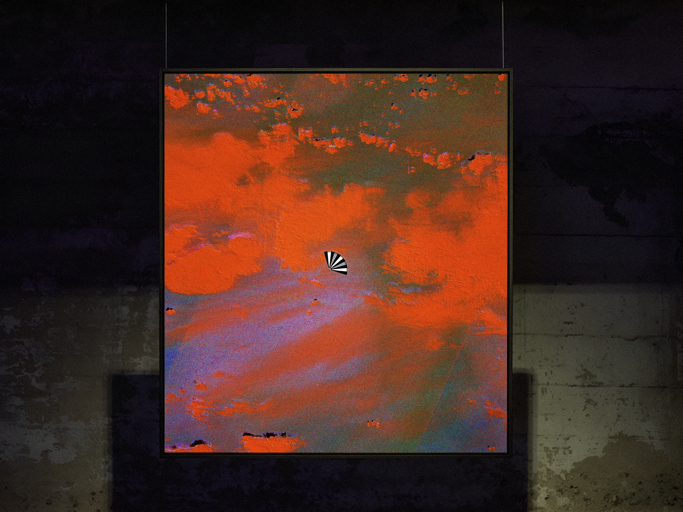
Still Nothing (Hy Brasil), multispectral satellite data, archival print on cotton-rag paper, 100cm x 111cm.
Image courtesy of Onkaos & SOLO Contemporary.
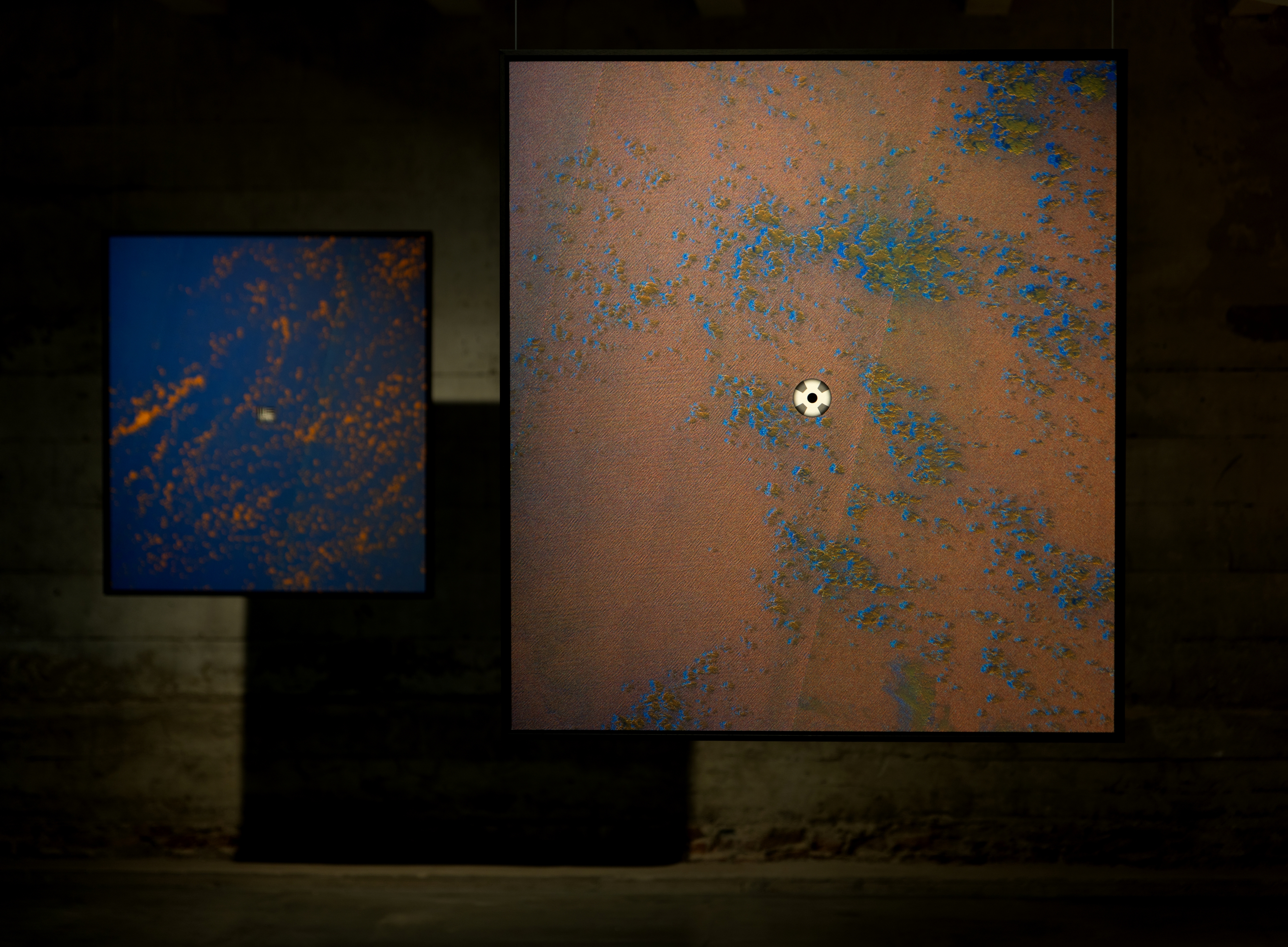
Still Nothing (Sandy Island) and Still Nothing (Los Jardines), multispectral satellite data, archival print on cotton-rag paper, 100cm x 111cm.
Image courtesy of Onkaos & SOLO Contemporary.
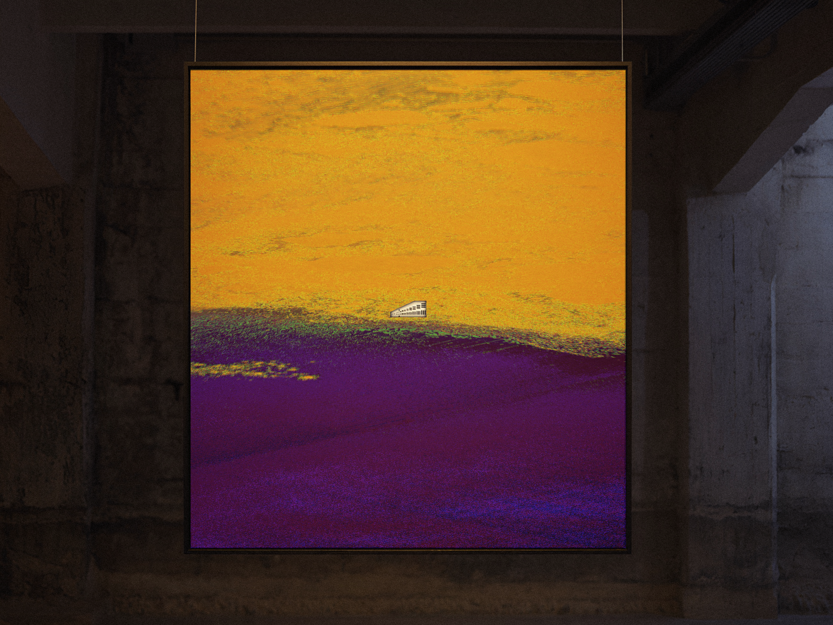
Still Nothing (Sannikov Land), multispectral satellite data, archival print on cotton-rag paper, 100cm x 111cm.
Image courtesy of Onkaos & SOLO Contemporary.